National Mine Map Repository
The National Mine Map Repository (NMMR) collects and maintains mine map information for the entire country. The NMMR acquires maps through public outreach with state and federal environmental agencies as well as mining companies, engineering and consulting firms, surveying companies, universities, and private citizens.
The facility stores data on more than 275,000 mines from throughout the United States. The mines have been either closed or abandoned and may be surface or underground mining operations. The repository's data dates from the 1790s to the present day. Maps are archived digitally and available to view. Visitors may access the database to search through over 40 fields of information collected from the maps.
Images are available upon request. The NMMR team may be reached at [email protected].
Access the NMMR Database System Here
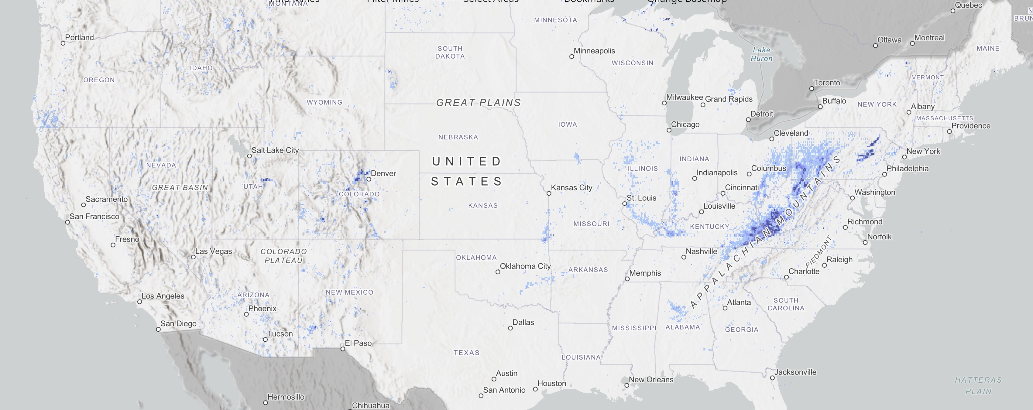
Visit our updated web map where you can view maps in our collection with a single click. Pan around for statistics in regional clusters. Mine maps are always still available by request: simply submit a request or email the team for help.
Visit the OSMRE Newsroom to hear a Mine Map story: A Bright Spot in a Dark History.
The National Mine Map Repository (NMMR), established by the Federal Coal Mine Health and Safety Act of 1969, is charged with maintaining an archive of all closed and abandoned mine maps from throughout the United States. Through its expert analysis of mine maps and related information, the NMMR assists both the private and public sectors in evaluation of related data for economic valuation, risk assessment, industrial and commercial development, highway construction, and the preservation of public health, safety, and welfare. The NMMR strives to increase public use and accessibility of its unique information by transforming its archive into digital geo-referenced media.
Mine maps within the Office of Surface Mining Reclamation and Enforcement (OSM) National Mine Map Repository (NMMR) are not guaranteed to be accurate, correct, or complete.
All maps in the NMMR have been donated to OSM. The information contained therein cannot be verified and so cannot be guaranteed.
OSM’s inability to guarantee includes, but is not limited to, the following:
- The accuracy of the mine maps within the NMMR.
- The reliability of findings based on data from the maps.
- The reliability of findings from digital mapping programs.
- The completeness of the maps, as they may not reflect prior or more recent mining.
- The accuracy of any geo-referenced mine maps found in the NMMR.
In 1969, an act of Congress established the need for a national mine map repository. The repository was to be funded and assigned to the Department of the Interior (DOI), Bureau of Mines (BOM) in 1970. A repository was set up at a BOM office in Pittsburgh, Pennsylvania that covered all states east of the Mississippi River with the exception of Louisiana and Minnesota. Those two states, together with most states west of the Mississippi River, were covered by a repository at the BOM Intermountain Field Operation Center in Denver, Colorado. Northwest states were covered by the BOM office in Spokane, WA.
In 1982, the responsibility for the repository and its staff was formally transferred to DOI's Office of Surface Mining Reclamation and Enforcement (OSM). Later, when BOM was dissolved in 1996, the maps from each BOM office were consolidated into two OSM repositories: one each in the cities of Pittsburgh and Wilkes-Barre, Pennsylvania. The Wilkes-Barre Repository solely covered the anthracite coal region of northeastern Pennsylvania. In 2011, the Wilkes-Barre Mine Map Repository closed. The entirety of the National Mine Map Repository's collection now resides in the Green Tree (Pittsburgh), PA office.
From the beginning, the mission of the repository has been to obtain authoritative maps of completed mining operations and preserve them for future generations. High priority is given to maps of mines in areas where the potential for adverse impact to the environment is most significant. The NMMR, in addition to being an archival entity concerned with the preservation of mine maps, is a storehouse of information on mines. The NMMR index system is a database of mining-related information. It is a valuable resource for identifying mineral and energy reserves and for addressing mining-related environmental issues. The information is made available to Federal and state geological surveys, state mining bureaus, mining companies, oil and gas companies, conservationists, research and planning organizations, water pollution boards, city and industrial planners, highway engineers, building contractors and real estate developers, and private citizens.
Today the NMMR is a modern high-tech facility with leading-edge map scanning and archiving capabilities and SQL data index. As of September 10, 2025, the primary archive contains over 319,000 .tiff images and resides on over 31 TB of storage space.
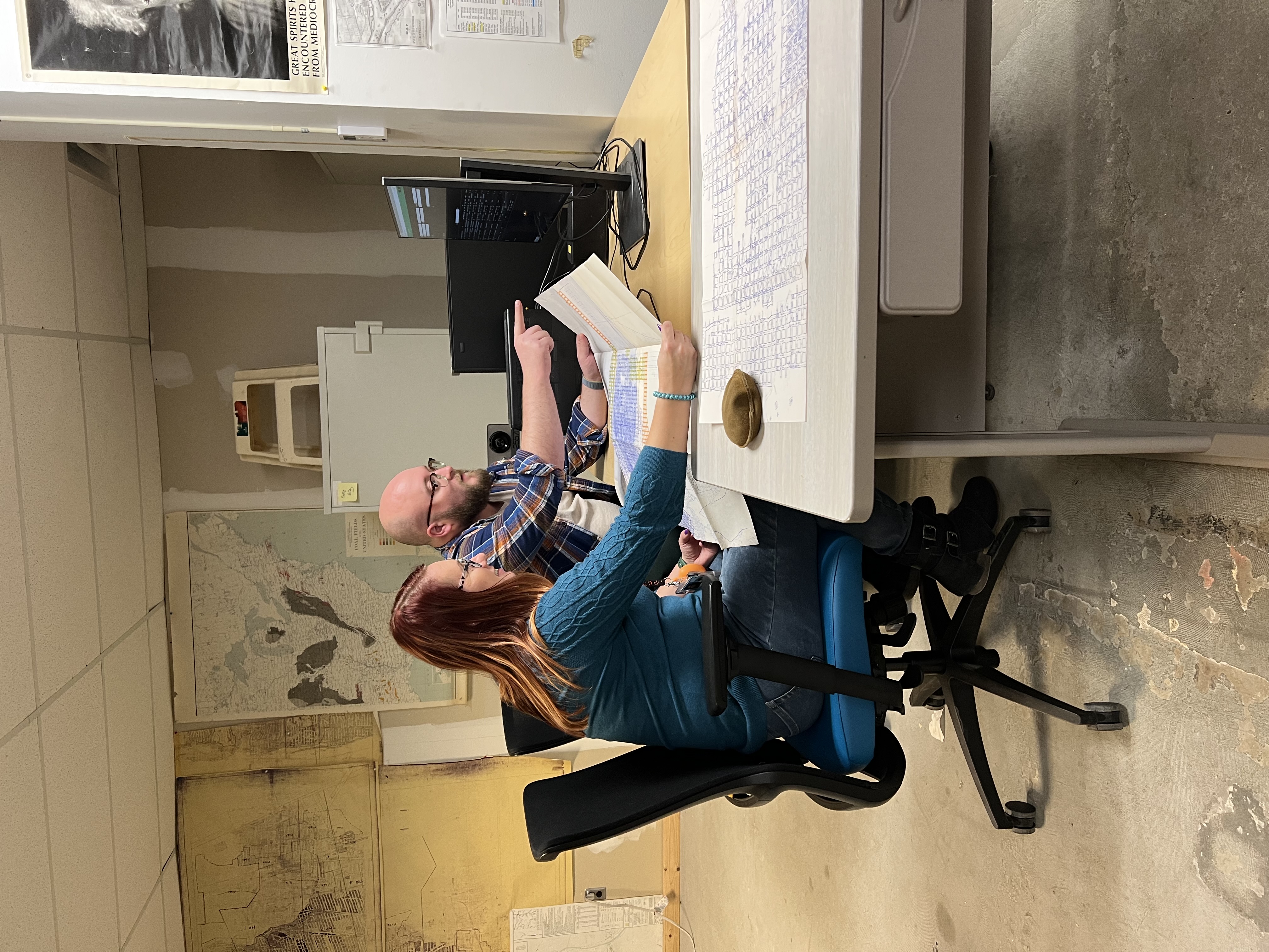
The NMMR accepts maps in any format: hard copies like canvasbacks or linens, film reels, aperture cards, or directly as scans. As maps are obtained at the repository, they are inventoried and assigned a unique identification number (document number). The maps are then scanned or saved in a digital format (.tiffs) and stored on the repository's servers. Large maps may require multiple scenes to capture their extent. Each image is thoroughly examined and its data recorded in the database. All scans and data endure quality reviews.
The NMMR acquires maps through a vigorous outreach program directed at the public and state and federal environmental agencies.
Other sources include:
- Mining companies
- Engineering and consulting firms
- Surveying companies
- Universities
- Private citizens
The NMMR is always seeking donations of mine maps to add to its collection. When maps are received, they are scanned, their data is recorded, and the images and data are made available to the public. The maps are then returned to the donor. The NMMR does not retain hard copies of maps.
If you have mine maps that you would like to donate, please contact the NMMR.
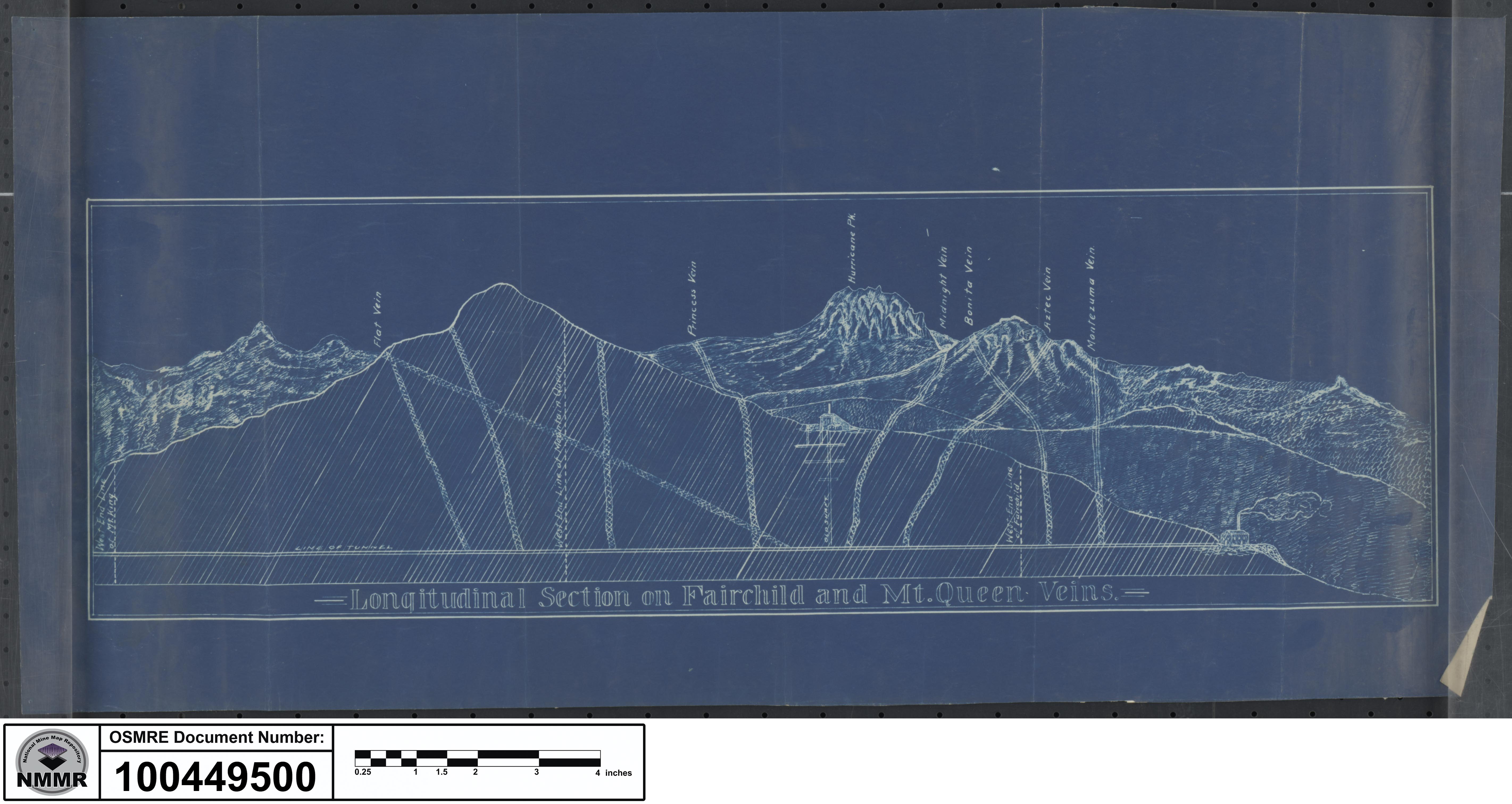
Blueprint cross-section. Document number 1004495.
The NMMR provides services ranging from retrieving mine-related data for economic analysis to determining the potential risk associated with underground mining. The NMMR does not provide assessments, though its data may aid public and private clients in doing so. The expert staff of geologists, geographers, and program specialists are available to aid any clients in understanding the maps and their notations.
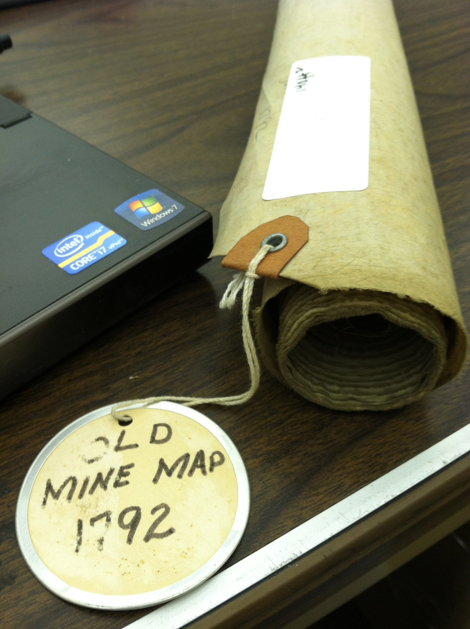
The oldest mine recorded at the repository is the Old Mine from 1792.
Through analysis of mine maps and related information, the repository assists private and public sectors in industrial and commercial development, highway construction, and the preservation of public health, safety, and welfare. In addition, we collect, reproduce, and maintain a national inventory of mine maps and supporting documentation for private and public interests.
The NMMR contains digital and microfilm maps of surface and underground coal, metal, and non-metal mines throughout the United States. Some of the information that can be found in the repository includes:
- Mine and company names.
- Underground mine plans including mains, rooms, and pillars.
- Closure maps.
- Adjacent mines.
- Man-ways, shafts, mine surface openings, barrier pillars, and ventilation facilities.
- Geologic information like bed name, bed thickness, depth, drill-hole data, cross-sections, elevation contours, structures, and outcrops.
- Geographic data including abandoned railroad lines and stations, coal towns, surface facilities, roads, ponds, streams, and property survey points.
- Districts, townships, sections, ranges, counties and municipalities, latitudes and longitudes, elevation benchmarks, surface elevations, gas, oil wells, and drill-hole locations.
The NMMR continues to work towards a more accessible, spatial database by digitizing, geo-referencing, and making the map images available on the cloud for public download.
The following is an example of some of NMMR clients and their mapping needs.
- Private Citizens/Homeowners: Inquire about past mining activity underlying their residence/community to access potential property hazard information related to past coal mining. They may also request information about mine subsidence insurance. There is no charge to private citizens and homeowners for the services of the NMMR.
- Consultants: Identify specific project areas and request information on various mine seams, mine depth, extent of mine, closure dates, detailed maps of mine workings, and mine operators to use as a basic source of geological and engineering data.
- Government Agencies: Request for information on subsidence, abandoned mine drainage, mine fires and rescue operations, for highway and bridge construction, or public display at municipal buildings or town meetings. The information may also be requested to conduct health and safety activities and remediation.
- Developers and Contractors: Request mine maps to determine the extent of mine workings and mine depth for pre-construction. They require information on coverage over mines to determine a need for support structures or to assist in making decisions relative to land use, foundation design, etc.
- Architects: Utilize mine map information in their design of structures. The information is necessary for decisions on the types of foundations and weight displacements.
- Realtors: Request information on abandoned mines within a given municipality. Their primary concern is to identify the distance of mines that underlie individual homes and whether information on mine subsidence insurance is necessary.
-
Mining Companies: Utilize mine maps to prepare mine permit applications for new or existing mines and may request mine map copies for further evaluations.
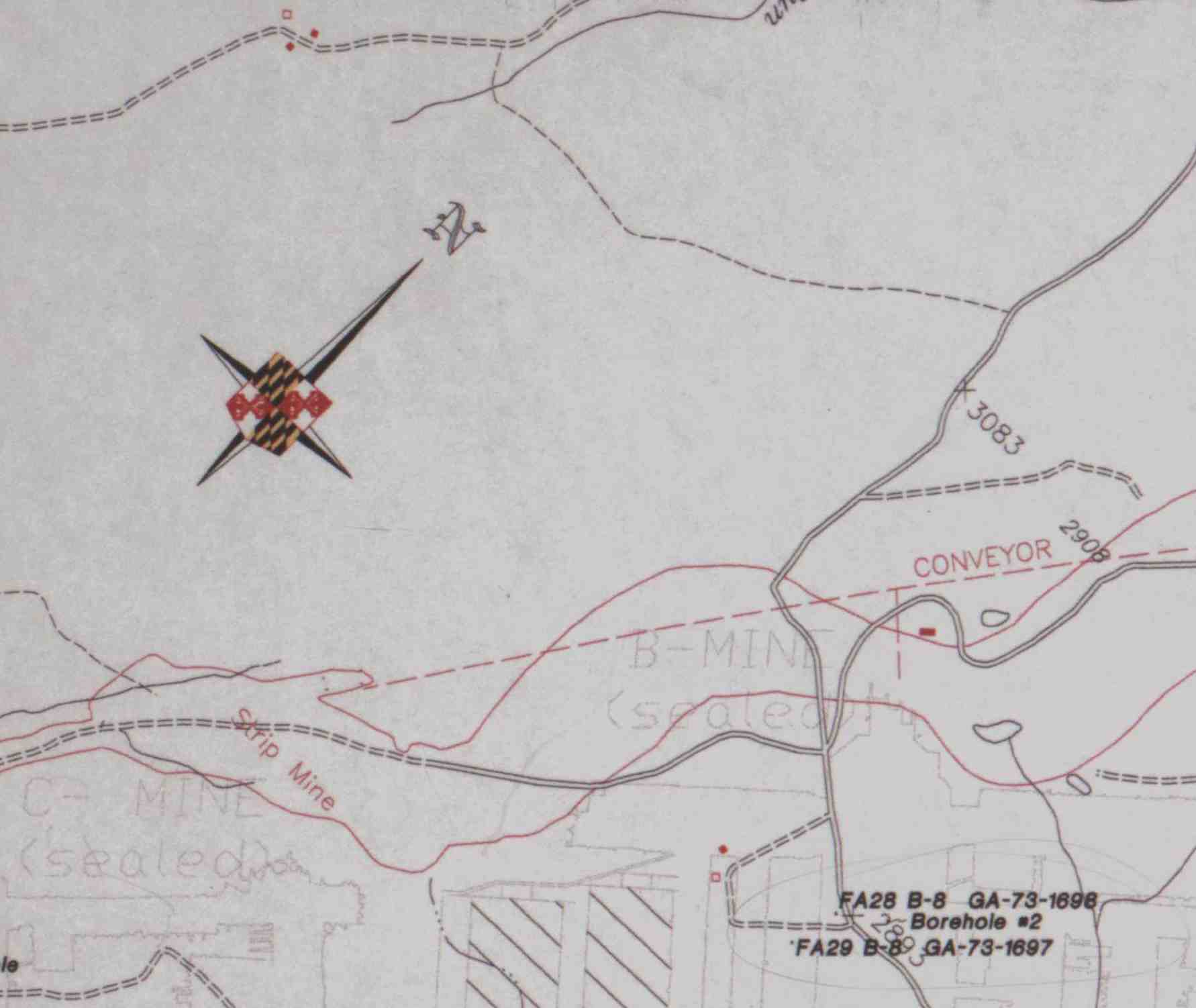
Close-up of document number 390290.
The NMMR utilizes various equipment to accomplish its mission of protecting and preserving mine maps for future generations. The repository has rolled film, aperture card, track, and flatbed scanners, as well as film viewers and a humidification area. See below for specifications.
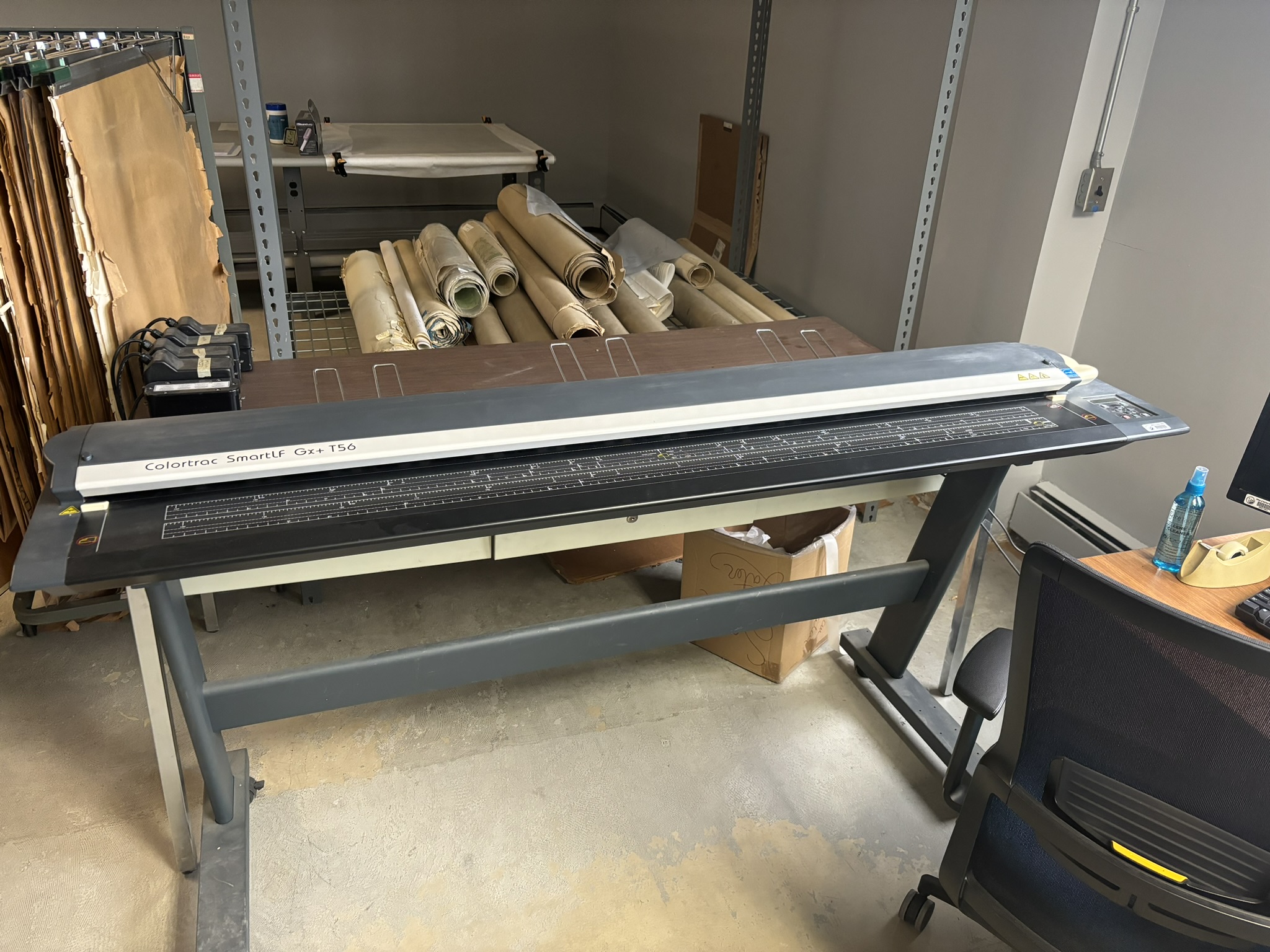
Colortrac GX+ T56 Roll Scanner
- Scans media up to .08" thick (aka Mr. Roboto)
- Fast! 1.5"/sec scan speed
- Up to 600 dpi, 48-bit color
- Unique instant-on, long-life bi-directional LED illumination system
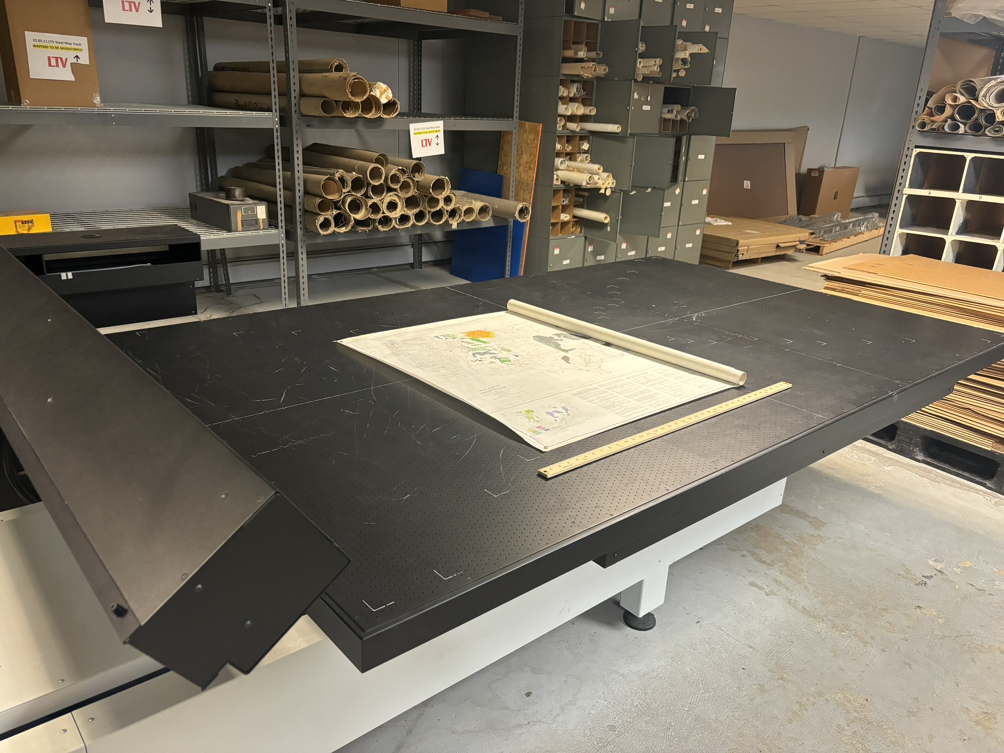
Cruse Table Scanner CS 285/1100 ST/FA
- 60" x 100" (aka Lucille II)
- Large-format fine art scanners
- Magnetic vacuum table
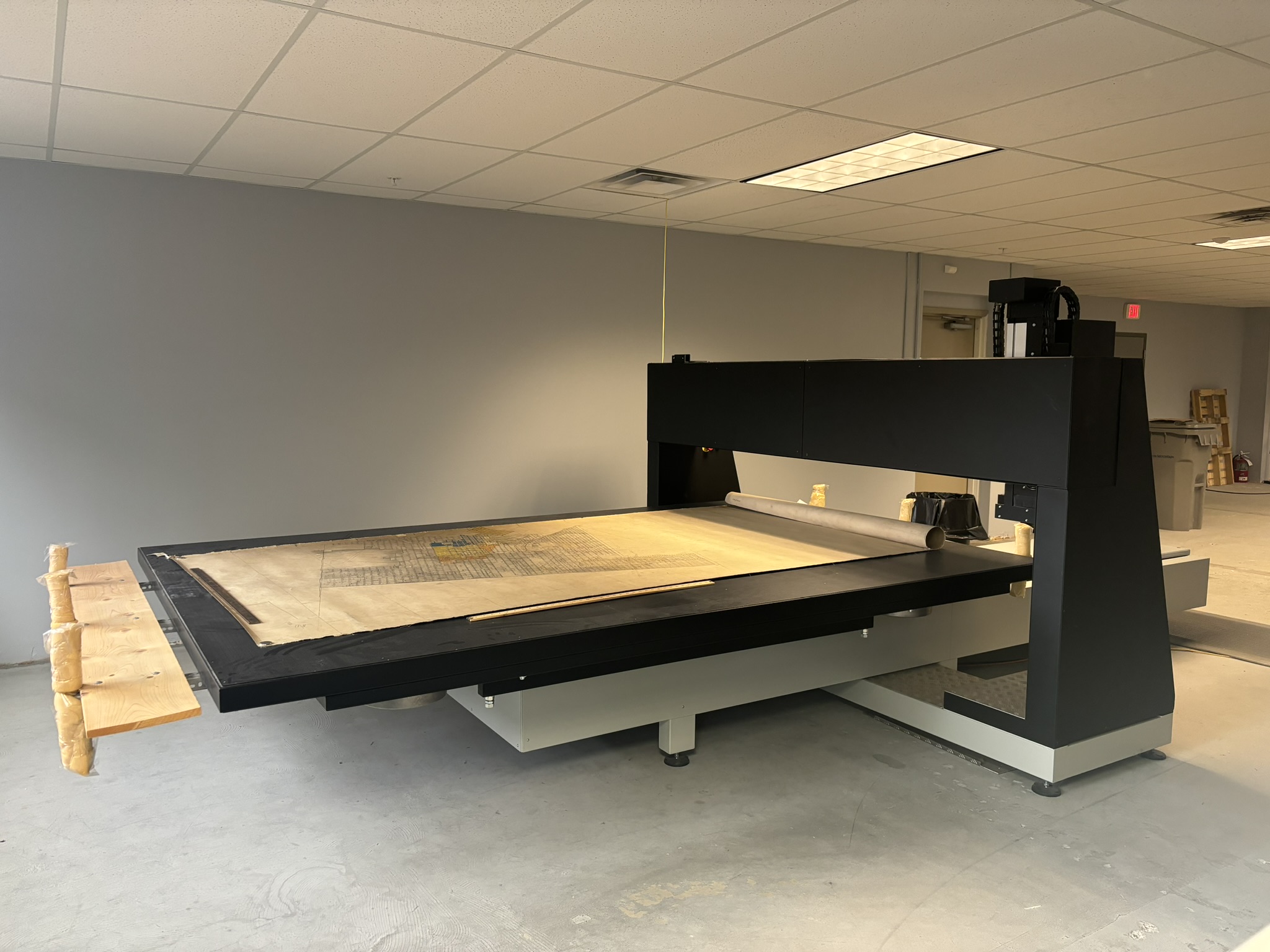
CS 360 ST-P Cruse Portal Scanner
- 80" x 120" (aka Gus)
- Scans at 600 dpi, 48-bit color (in strips)
- Strips stitched together and saved at 300 dpi
- Resulting images may be bigger than 6 GB
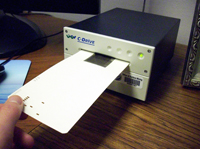
C-Series Wicks & Wilson Aperture Card Scanners
- Scans film according to original reduction ratio
- Resulting resolution 100-400 dpi at full scale
- Black and white or 8-bit grayscale
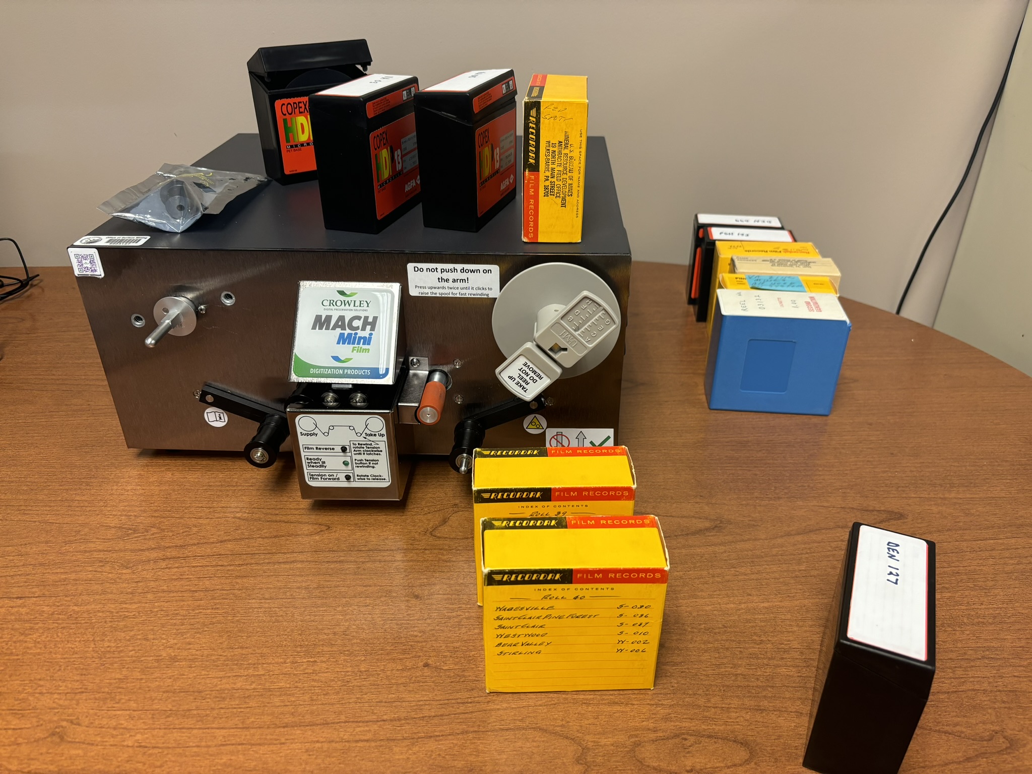
Crowley MACH Mini Film Scanner
- Optical character recognition (OCR)
- Captures 500 images per minute (ipm)
- Scan 100′ and 215′ microfilm in open spool
- Full 8,192 pixel CCD line array camera
- 100-600 true optical dpi with 4x-96x reduction ratio
Below is a listing of additional mine map repositories:
- Colorado Geological Survey
- Illinois Coal Mines Quadrangle Maps and Directories
- Kentucky Geological Survey
- Kentucky Mine Mapping Information System
- Pennsylvania Spatial Data Access (PASDA)
- USGS Geographic Names Information System (GNIS)
- USGS Historical Maps
- West Virginia Geological and Economic Survey (WVGES)
Mine maps within the Office of Surface Mining Reclamation and Enforcement (OSM) National Mine Map Repository (NMMR) are not guaranteed to be accurate, correct, or complete.
All maps in the NMMR have been donated to OSM. The information contained therein cannot be verified and so cannot be guaranteed.
OSM’s inability to guarantee includes, but is not limited to, the following:
- The accuracy of the mine maps within the NMMR.
- The reliability of findings based upon data from the maps.
- The reliability of findings from digital mapping programs.
- The completeness of the maps, as they may not reflect prior or more recent mining.
- The accuracy of any georeferenced mine maps found in the NMMR.
The NMMR Explained
For More Information Contact the Mine Map Team
Email, team: [email protected]
Phone, Jess Reitz: (412) 937-2114