

Reclamation in Action
Two centuries of US coal mining occurred before the passage of the Surface Mining Control and Reclamation Act (SMCRA) of 1977. Land that was once considered dangerous and unwelcoming is finding new purpose through innovative reclamation projects.
-
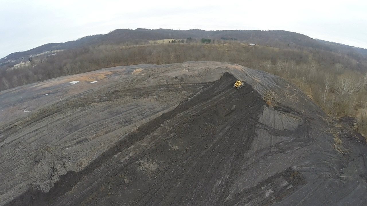
Reclaiming a Company Town Project in Mather, PA. During construction (2015).
-
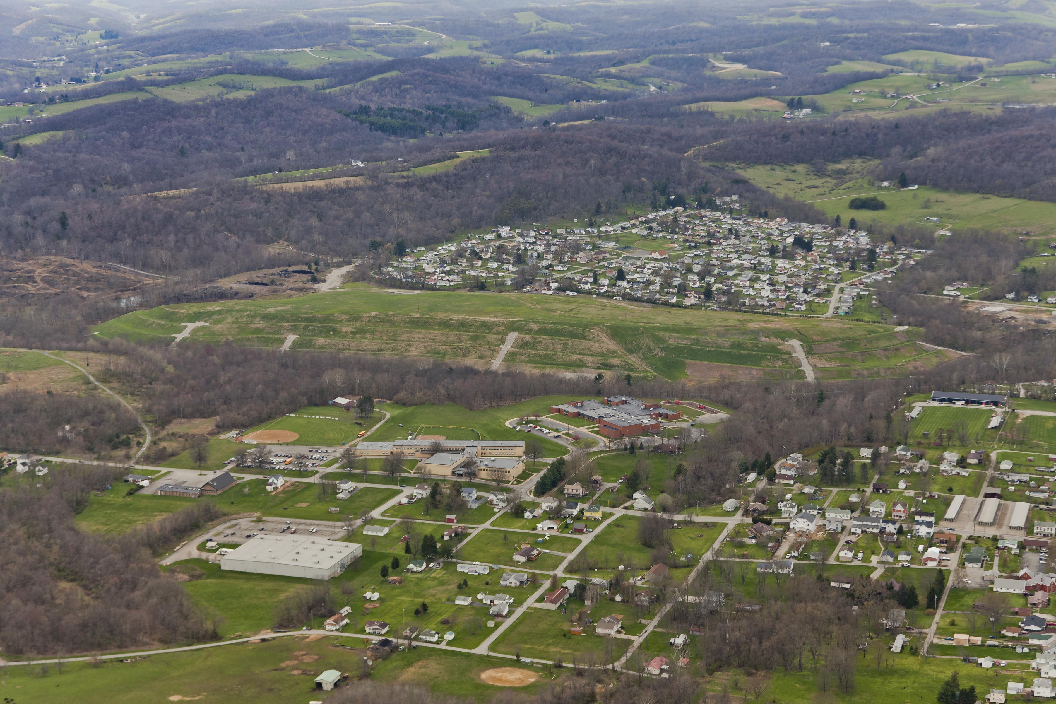
Reclaiming a Company Town Project in Mather, PA. After construction (2016).
HEALTH & SAFETY
OSMRE partners with state and tribal governments, community groups and mining companies to protect the public from mining-related hazards.
The judges choose the Highway 15 Pit Subsidence Emergency Project as the Mid-Continent Regional Award Winner for stabilizing the dangerous pit type subsidence. This type of subsidence include deep sided holes that form in the ground surface as the result of roof collapse within room and pillar mines.
The Illinois Department of Transportation summoned the help of the Illinois Abandoned Mined Lands Division and today permanent site stabilization has been successfully achieved due to the combined efforts and corporation of these two agencies.
-
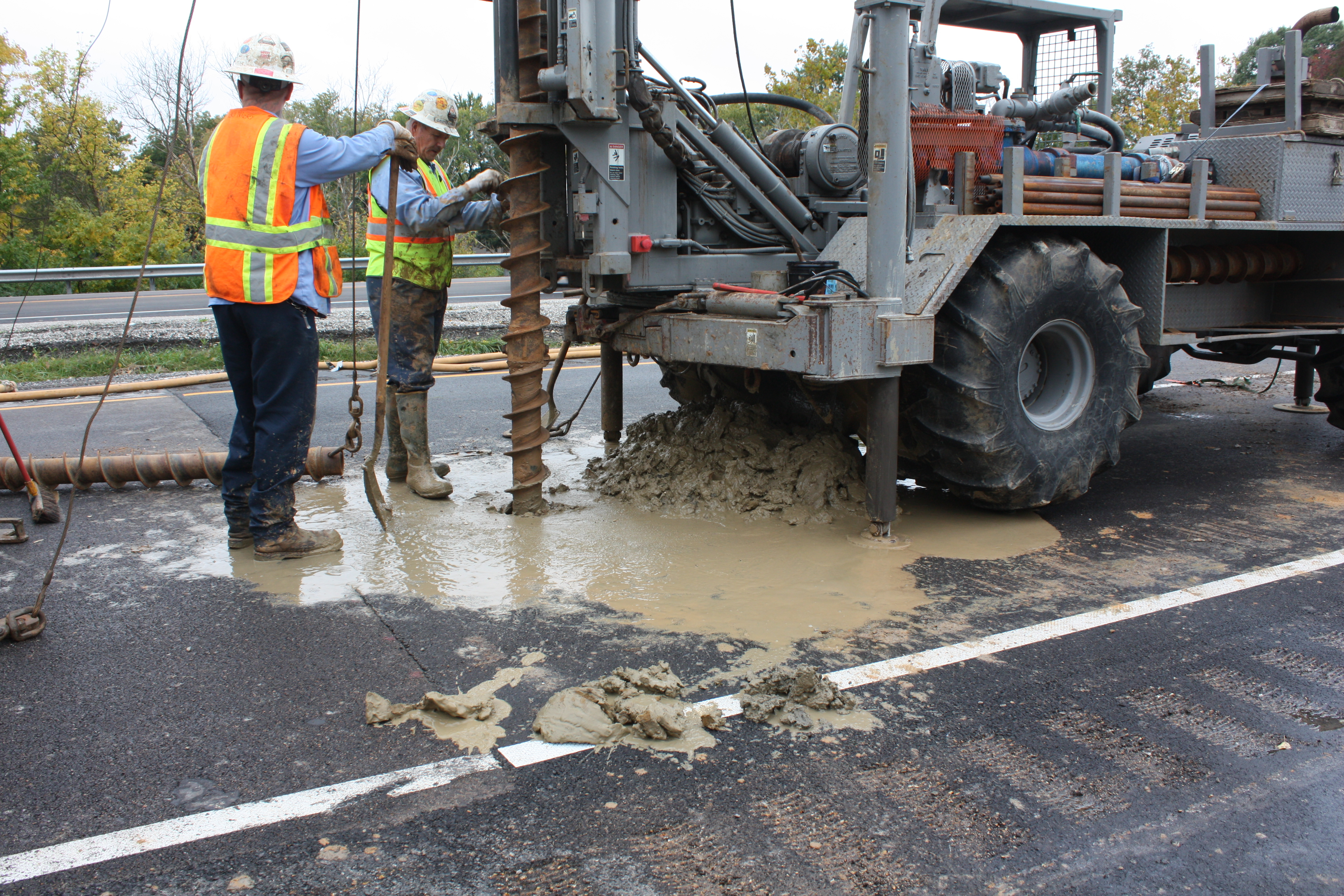
Drilling and sampling for determination of rock/coal depths.
-
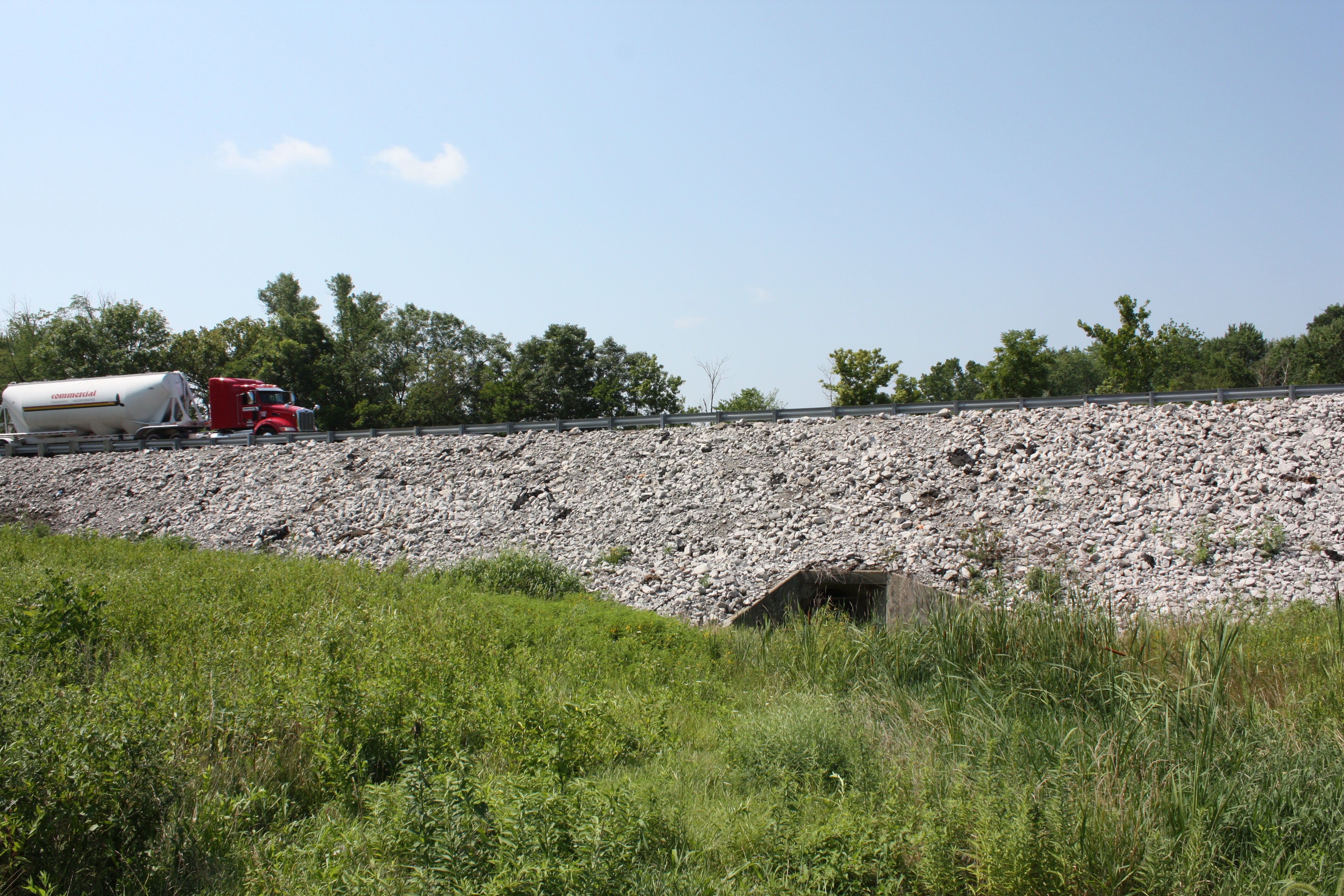
Completed road stabilization project.
-
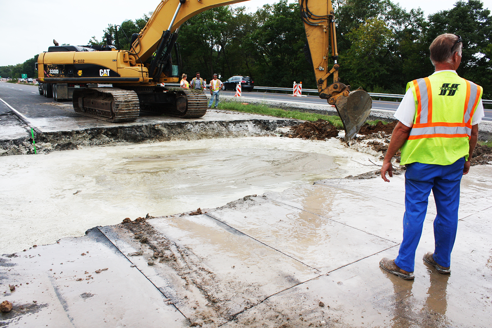
330 cubic yards of flowable fill placed to elevation of pavement subgrade.
WILDLIFE RESTORATION
The return of various types of wildlife, to reclaimed sites, is one aspect that OSMRE technical experts use to evaluate the conditions of the environment. OSMRE uses this information to accurately assess how well the methods used in a particular project worked for the respective region.
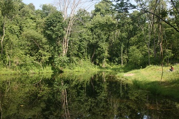
The McCreary project required a ten year commitment among four state agencies, eight Federal agencies, and a non-profit outdoor advocacy group to clean up the damage from acid mine drainage that rendered several miles of Lower Rock Creek sterile of aquatic life.
The project covered four locations in Kentucky and Tennessee. Lower Rock Creek stretches from Kentucky's Pickett State Park, through the Daniel Boone National Forest, and into the Big South National Recreation area. Rock Creek is also home to more than 40 portals leading to hundred year old underground mines, and eight mine refuse dumps. Those killed aquatic life and limited the fresh water available for land animals. Rock Creek was the largest contributor of acid mine drainage to the Big South Fork of the Cumberland River until recently.
A wide ranging project carried out through the entire system reduced the monthly acidic load in the water by 99%. As a result, fish and other aquatic life and land-borne animals have returned to lower Rock Creek and White Oak Creek, and so have land borne animals. Today, the watershed is a prime location for fishing, hunting, hiking, backpacking, and camping and hosts thousands of people each year.
-
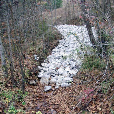
An example of the limestone channels created to help reduce PH levels in the watershed.
-
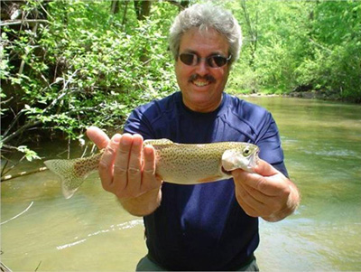
Fish and other wildlife have returned to the Lower Rock Creek Watershed.
TECHNOLOGY
Developing and transferring knowledge and technology is an integral part of OSMRE’s mission. OSMRE is dedicated to providing the most up-to-date tools to Federal and State staff to efficiently and effectively oversee current coal mining practices, and reclamation of abandoned mine lands.
Understanding the topography (landscape features) of a mine site is important in order to achieve effective reclamation. OSMRE is using a new ground based Lidar technology to get a better picture of mine site topography. A Lidar scan, which can be completed in only a few minutes, can produce a detailed 3D elevation model which can help regulators and mine operators better plan for reclamation. Creating Three Dimensional Mine Elevation Models features the usage of a Lidar Scan.
ECONOMIC DEVELOPMENT
OSMRE has funded projects that allow for growth throughout the regions and local communities. The partnerships and alliances that OSMRE builds upon for remining and reclamation efforts, prove to be a natural fit and ensure that reclamation of abandoned coal mines and regulation of current coal mining is accomplished.
The Pittsburgh Botanic Garden stands near where some of the nation’s first coal mines began operations in the late 1700’s. The unique site encompasses OSMRE’s entire mission in one small area. It is home to an abandoned mine land site. It is home to an active mine site. It is also the product of a private and public partnership dedicated to cleaning up the abandoned mine site in order to create the Garden.
The Garden is also a role model for how people with creative ideas to address environmental hazards can approach the government for help while building something for good. The Office of Surface Mining Reclamation and Enforcement provided not only environmental expertise, technical assistance, and funding for the project, but also advice on how Garden supporters might obtain the necessary permits to mine and utilize coal left on the old mine site to help fund all of the other activities.
The product of more than 25 years of ongoing effort to bring the project to fruition, the Garden opened its doors to the public in August 2014. When fully complete, the Pittsburgh Botanic Garden, located 20 minutes west of the city, will include 18 distinct gardens, five diverse woodland experiences, an amphitheater for outdoor concerts and performances, an event center and a botanic research facility.
-
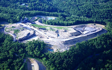
Aerial View of Pittsburgh Botanic Garden.
-
Stream in Pittsburgh Botanic Garden