


Indian Lands Program
Regulation of Coal Mining and Reclamation Operations on Indian Lands
OSMRE is the regulatory authority on all coal mining and reclamation operations located on Indian Lands. Indian Lands means all lands, including mineral interests, within the exterior boundaries of any Federal Indian reservation, notwithstanding the issuance of any patent, and including rights-of-way and all lands including mineral interests held in trust for or supervised by an Indian tribe.
Currently, OSMRE is the regulatory authority on coal mining and reclamation operations located on the Crow, Hopi, Navajo and Ute Mountain Ute reservations and all lands supervised by those tribes. As the regulatory authority, OSMRE is responsible for:
- The review of applications to conduct mining and reclamation operations
- Inspection of coal mining and reclamation operations to ensure public and environmental health protection
- Ensuring the full reclamation of the site before the lands are returned to the tribes
The Indian Lands Program is responsible for administering permitting activities associated with properties across the nation.
Four of these properties currently involve active mining and reclamation operations, while the remaining four no longer are being disturbed and involve only reclamation activities.
To ensure the protection of public and environmental health, OSMRE works in partnership with tribal governments, other federal agencies, such as: the Bureau of Indian Affairs (BIA), Bureau of Land Management (BLM), U.S. Fish and Wildlife Service, Environmental Protection Agency and Army Corps of Engineers. More information on this federal partnership with BIA and BLM can be found in Attachment G of the Onshore Energy & Mineral Lease Management Interagency Standard Operating Procedures.pdf
For more information on OSMRE's Indian Lands Program, contact Mychal Yellowman at [email protected]
J16, J19, & J21 Phase I Release of Liability Announcement
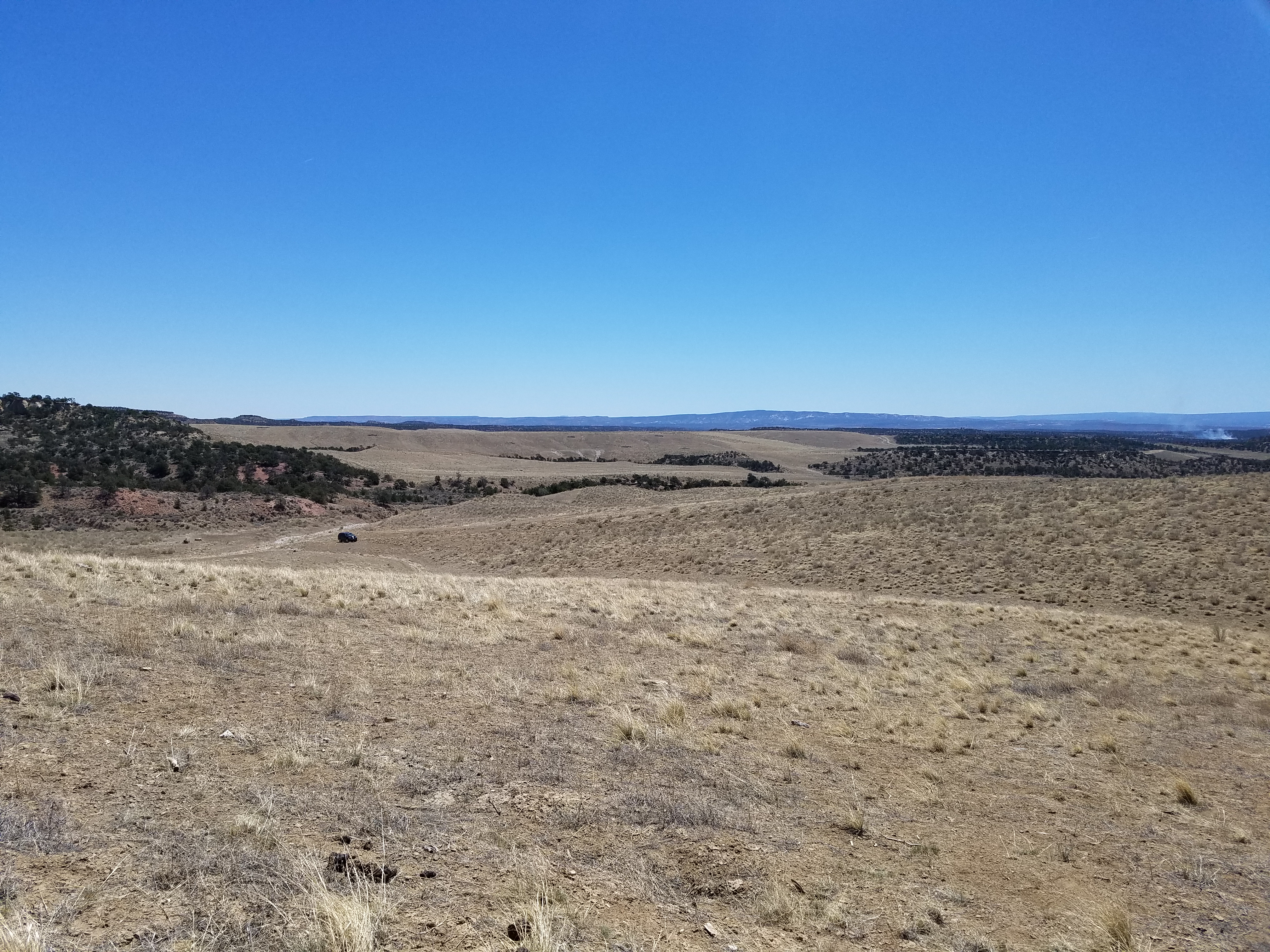
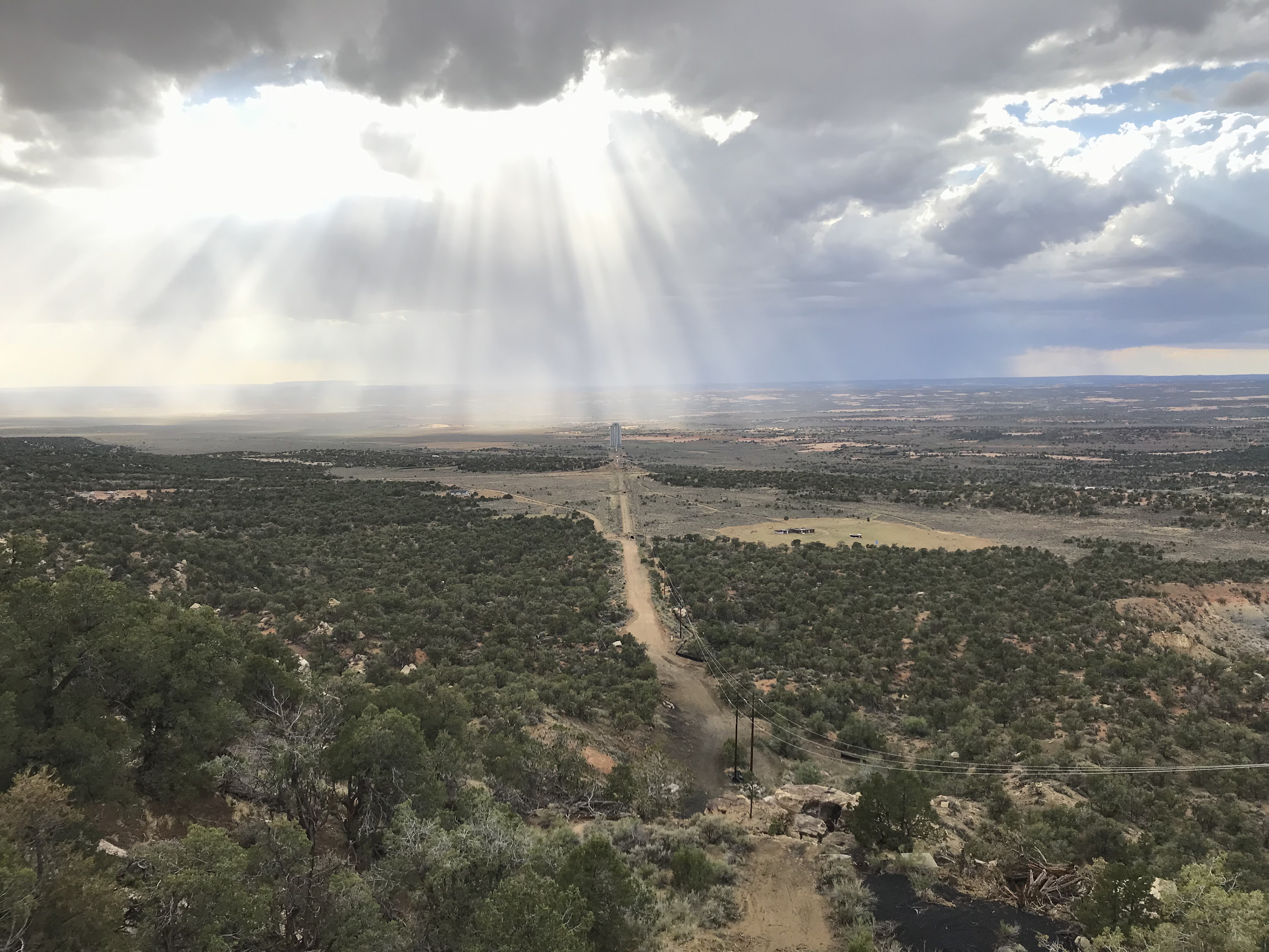
Peabody Western Coal Company (PWCC) has filed an application with the Office of Surface Mining Reclamation and Enforcement (OSMRE) for bond release on a portion of the lands in the J16, J19 and J21 Coal Resource Areas (CRA) within the Kayenta Mine Permit AZ-0001F. PWCC is seeking a release of Phase I bond liability for a portion of the J16, J19 and J21 areas currently under bond with Zurich American, Liberty Mutual, and SiriusPoint America Insurance and one Letter of Credit with Goldeman Sachs Bank, USA. PWCC is seeking a reduction in bond of $13,727,831 under the Phase I application. The total combined bond for Kayenta Mine is $107,171,138.
The Phase I bond release application consists of information currently contained in the AZ-0001F permit application package (PAP) approved October 3, 2017. The PAP outlines PWCC’s reclamation operations on Permanent Program Lands. The total area in J16, J19 and J21 requested for Phase I release is 611 acres. Reclamation was completed between 2011 and 2026. Reclamation activities were completed in accordance with the approved PAP and included backfilling, grading, mitigation of unsuitable material, drainage control construction, and replacement of suitable soil or plant growth media. The Kayenta Mine permit for the release area is under Navajo Tribal Coal Lease 14-20-0603-9910 and Hopi Tribal Coal Lease 14-20-0450-5743 and operates pursuant to Code of Federal Regulations (CFR), Title 30; Subchapter E, Part 750; Subchapter G, Parts 773 and 774; and Subchapter K, Parts 810 and 816. This notice is hereby given that:
1. The name and business address of the applicant is:
Peabody Western Coal Company, Kayenta Mine
P.O. Box 650
Kayenta, AZ 86033
2. The mine permit area is located approximately 18 miles south southwest of Kayenta, Arizona. The permit area for the Phase I bond release area is in USGS 7.5-minute quadrangle map “Yucca Hill” within the following lands of Navajo County, Arizona that are described relative to the Gila and Salt River Base Meridian as:
A total of 8 acres of land located within the J16 CRA. The computer-generated centroid location is Latitude 36O 29’ 05.3” N and Longitude 110O 17’ 35.6” W. A total of 420 acres of land located within the J19 CRA. The computer-generated centroid location is Latitude 36O 26’ 01.8” N and Longitude 110O 18’ 04.9” W. A total of 183 acres of land located within the J21 CRA. The computer-generated centroid location is Latitude 36O 25’ 25.9” N and Longitude 110O 17’ 39.7” W.
3. Application can be downloaded here:
This application is authored and provided by PWCC for OSM's review and decision. If you need assistance with this electronic document related to accessibility, please contact Mychal Yellowman at [email protected]
Locations of where copies of the application and permit are also available for public review and/or inspection are:
Navajo Nation Minerals Department
Office of Surface Mining
Window Rock Boulevard
Window Rock, AZ 86515
Forest Lake Chapter House
Navajo Route 41
17 Miles North of Pinon
Pinon, AZ 86510
Peabody Western Coal Company
Kayenta Mine
Mesa Central Warehouse Office Complex
8 Miles from Hwy 160 and Route 41 Junction
Kayenta, Arizona 86033
4. The name and address of the OSMRE-WRO representative where written comments, objections, requests for a public hearing, or requests for an informal conference may be submitted on or before 5:00 p.m., July 13, 2026, thirty (30) days after the last publication date are:
Ms. Amy Ryser
Western Region Office
Office of Surface Mining Reclamation & Enforcement
P. O. Box 25065
One Federal Center, Building 41
Lakewood, CO 80225-0065
5. Interested persons may obtain more information concerning the bond release by contacting Marie Shepherd, Senior Manager Environmental for PWCC at 928.280.7091.
6. The application has been filed with OSMRE and will be acted upon pursuant to the Permanent Regulatory Program (30 CFR Parts 750 and 774) approved by the Secretary of the Interior under Title V of the Surface Mining Control and Reclamation Act of 1977.
Kayenta Mine Permit Renewal Application
Pursuant to the Code of Federal Regulations (CFR), Title 30, Chapter VII, Subchapter E, Part 750 and Subchapter G, Parts 773 and 774, notice is hereby given that Peabody Western Coal Company (PWCC) has filed an application with the Office of Surface Mining Reclamation and Enforcement, Western Region Office (OSMRE) for renewal of Permit AZ-0001F covering mining and reclamation operations at Kayenta Mine, Navajo County, Arizona. The permit renewal does not affect any terms and conditions of the existing coal leases, and no new coal leases are associated with the renewal. No new permit area is proposed beyond that which is currently approved and no new mining will be approved. The term of the renewed permit will be from July 6, 2025 through July 5, 2030. This notice is hereby given that:
The name and business address of the applicant is:
Peabody Western Coal Company,
P. O. Box 650, Navajo Route 41, Kayenta, Arizona, 86033.
The Kayenta Mine Permit AZ-0001F area is in northeastern Arizona near the northern edge of Black Mesa within the protracted boundaries of Townships 35 through 37 North, Ranges 17 through 19 East. The operation is contained within the areas shown on the following U.S. Geological Survey 7.5-minute quadrangle maps: Longhouse Valley, Marsh Pass S.E, Owl Spring, Great Spring, Yucca Hill, and Cliff Rose Hill. The permit area is located within the following lands of Navajo County, Arizona that are described relative to the Gila and Salt River Base Meridian.
T35N, R18E - Sections 13, 14, 24, 25, and 36;
T35N, R19E - Sections 1-5 and 7-36; T36N, R17E - Sections 1-4, 11, and 12;
T36N, R18E - Sections 1-18, 20, and 22-26;
T36N, R19E - Sections 15-22, 25-30, and 32-36;
T37N, R18E - Sections 28, 29, and 32-36.
Paper copies of the application are available for public review and/or inspection at the following four listed locations:
Navajo Nation Minerals Department
Window Rock Boulevard
Window Rock, AZ 86515
Forest Lake Chapter House
Navajo Route 41
14 miles north of Pinon
Pinon, AZ 86510
Office of Surface Mining Reclamation and Enforcement
Western Region Office
One Federal Center, Bldg. 41
Denver, CO 80225
Hopi Office of Mining and Mineral Resources
Highway 264
1 mile east of Kykotsmovi
Kykotsmovi, AZ 86039
The name and address of the OSMRE representative where written comments, objections, or requests for an informal conference may be submitted on or before 5:00 p.m. MDT, August 11, 2025, which is no less than thirty (30) days after the last publication date:
Ms. Amy Ryser
Office of Surface Mining Reclamation and Enforcement
P.O. Box 25065
One Federal Center, Building 41 Denver, CO 80225
(303) 236-4690
email: [email protected]
Per 30 CFR 773.6(c), any person having an interest that is or may be adversely affected by the decision on the application may request an informal conference. The request must briefly summarize the issues to be raised by the requestor and must state whether the requester desires to have the conference conducted in the locality of the proposed operation.
The 2025 Permit Renewal Application can be downloaded here: 2025PermtiRenewalApplication.pdf
OSMRE will continue collecting comments on the permit renewal until December 31, 2025.
Kayenta Mine Complex Story Map
OSM's Kayenta Mine Complex Story Map
Reclaim Restore & More Podcast with Mychal Yellowman on the Kayenta and Black Mesa mine sites
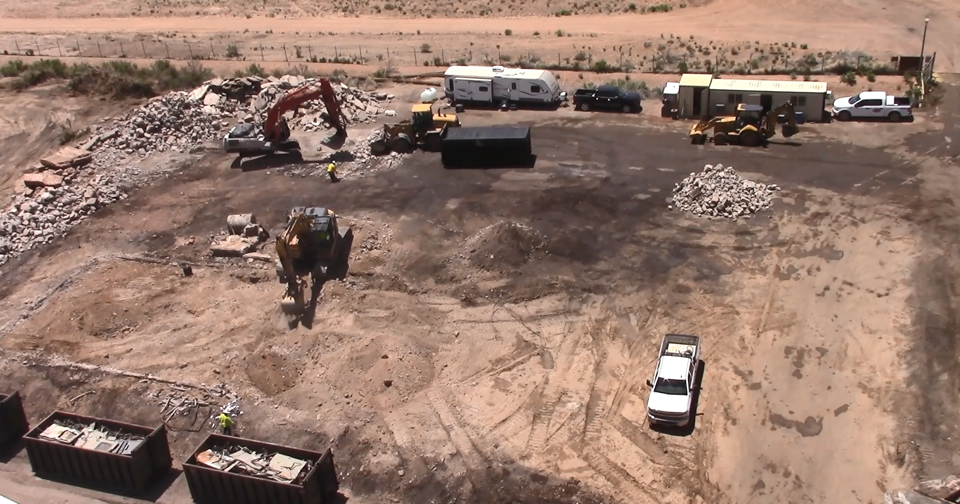
The Black Mesa Preparation Plant is located on Hopi and Navajo land. No coal was mined within its 40 acre footprint, but it was used by the Black Mesa Mine. The Black Mesa Preparation Plant is under full reclamation.
For more information on the Black Mesa Preparation Plant, contact OSMRE Mine Team Leader, Amy Ryser at [email protected]

Proposed No Name Permit: NM-0043
PUBLIC NOTICE
Navajo Transitional Energy Company (NTEC) Navajo Mine is submitting a permit application to conduct surface coal mining and reclamation operations pursuant to the requirements of the Surface Mining Control and Reclamation Act of 1977 for the No Name Permit Area.
NTEC proposes to develop approximately 11,526 acres within NTEC’s existing Navajo Mine Lease 14-20-603-2505 with the Bureau of Indian Affairs. The new permit area will encompass the remaining acres in the mine lease.
The company proposes to relocate 9.6 miles of the Burnham Road (BIA Road 3005; Navajo Road N-5082) to the eastern portion of the NTEC Mine Lease due to the close proximity of the road to current mining operations and to improve safety and access for local residents and others using the road.
This notice is hereby given that:
The Name and Business Address of the Applicant is:
Navajo Transitional Energy Company
P.O. Box 958
Shiprock, New Mexico, 87420
The mine permit area is located approximately 6 miles southwest of Fruitland, New Mexico (USGS 7.5 minute quad maps: “The Hogback North, The Hogback South, Fruitland, Newcomb N.E., and The Pillar N.W”). The No Name Permit area is located within the following lands of San Juan County, New Mexico which are described relative to the New Mexico Principal Meridian:
This tract is located within T26N R16W, Sections 22, 23, 24, 25, 26, 34, 35, 36; T25N R16W, Sections 1, 2, 3, 4, 5, 8, 9, 10, 11, 12, 13, 14, 15, 16, 17, 20, 21, 22, 23, 24. A reference marker, the South Quarter Corner of Section 24.
Beginning at a L170; thence N 00°23'36" E a distance of 2632.53' to a L168; thence N 00°19'51" E a distance of 5280.86' to a L166; thence N 00°22'05" E a distance of 2646.89' to a L164; thence N 89°48'09" W a distance of 1317.22' to a L162; thence N 00°07'27" E a distance of 1322.11' to a L160; thence N 89°35'33" W a distance of 1322.20' to a L158; thence N 00°18'13" E a distance of 1318.08' to a L156; thence N 00°25'39" E a distance of 2637.87' to a L154; thence S 89°37'39" E a distance of 3964.11' to a L152; thence N 00°23'12" E a distance of 10552.14' to a L146; thence N 89°26'08" W a distance of 1321.78' to a L144; thence N 00°30'37" E a distance of 1320.76' to a L142; thence N 89°43'11" W a distance of 1322.23' to a L140; thence N 89°04'48" W a distance of 4828.31' to a ; thence N 29°12'52" W a distance of 3284.91' to a ; thence N 10°31'01" W a distance of 836.09' to a ; thence S 82°35'21" W a distance of 1896.48' to a P8; thence S 57°10'29" W a distance of 2201.74' to a P9; thence S 38°16'44" W a distance of 1795.97' to a P10; thence S 14°43'53" W a distance of 2201.47' to a P11; thence S 20°31'35" E a distance of 7617.63' to a P12; thence N 89°27'34" W a distance of 1603.97' to a P13; thence N 47°29'32" W a distance of 2106.66' to a P14; thence S 89°32'52" W a distance of 2158.17' to a P15; thence S 22°14'19" W a distance of 2049.86' to a P16; thence S 08°39'26" E a distance of 2890.78' to a P17; thence S 81°07'55" W a distance of 3937.80' to a P18; thence S 18°22'54" W a distance of 3182.83' to a P19; thence N 82°34'30" E a distance of 1956.79' to a P20; thence S 20°27'10" E a distance of 3004.00' to a P21; thence S 56°34'56" W a distance of 2116.06' to a P22; thence S 39°36'12" E a distance of 2403.97' to a P23; thence S 71°24'18" W a distance of 2033.16' to a P24; thence S 00°19'21" W a distance of 1791.50' to a P25; thence S 89°30'33" E a distance of 1017.23' to a P26; thence S 17°45'13" E a distance of 1186.99' to a P27; thence N 89°34'48" W a distance of 1326.83' to a P28; thence S 00°18'37" W a distance of 670.94' to a P29; thence S 65°39'21" E a distance of 2505.99' to
a P30; thence N 45°29'39" E a distance of 1168.27' to a P31; thence S 28°51'39" E a distance of 4787.49' to a P32; thence N 90°00'00" E a distance of 7709.09' to a P33; thence N 45°31'40" E a distance of 2644.85' to a P34; thence S 89°44'32" E a distance of 1150.61' to a L175; thence S 89°30'34" E a distance of 3965.06' to a L170; which is the point of beginning, having an area of 502012230.8 Square Feet, 11524.615 Acres
Copies of the application are available for public review and/or inspection on this webpage below this notice, or at the following locations:
The Navajo Nation Minerals Department
Corner of Morgan Blvd and Window Rock Blvd
Window Rock, AZ 86515
(928) 871-6587
Tiis Tsoh Sikaad (Burnham) Chapter
12 miles east of US 491 on Navajo Route 5 and 0.5 mile South on Navajo Route 5080
Newcomb, NM 87455
Nenahnezad Chapter
West Hwy 64, South on County Road 6675, North on Navajo Route 365,
Fruitland, NM 87416
Farmington Public Library
2101 Farmington Ave
Farmington, NM 87401
Any person with an interest that is or may be adversely affected may submit written comments, objections, or a request for an informal conference on the application, within 30 days of the fourth and last publication of this notice. The name and address of the OSMRE representative where written comments, objections, or requests for an informal conference may be submitted is:
Flynn Dickinson [email protected]
Navajo Mine Team Leader
Office of Surface Mining Reclamation and Enforcement
Western Region Indian Lands Program
P.O. Box 25065
Lakewood, Colorado 80225-0065
The application has been filed with OSMRE and will be acted upon pursuant to the permanent regulatory program for Indian Lands (30 CFR Part 750) approved by the Secretary of the Interior under Title V of the Surface Mining Control and Reclamation Act of 1977.
Pending Federal Permit NM-0043 Application Package
Table of Contents
Part 1: Legal, Financial, Compliance, and Related Information
Section 1 - Permitting History
Section 2 - Operation and Permit Description
Section 3 - Permittee, Resident Agent, Payer of AML Reclamation Fees
Section 4 - Permittee Ownership and Control
Section 5 - Compliance Information
Section 6 - Land Ownership and Control
Section 7 - Liability Insurance
Section 8 - Compliance with Air and Water Quality Laws and Regulations
Section 9 - Compliance with Health and Safety Standards
Part 2: Premining Environment Resources Information
Section 10 - Land Use
Section 11 - Cultural, Historic, and Archeological Resources
Section 12 - Climate
Section 13 - Topography
Section 14 - Soil
Section 15 - Vegetation
Section 16 - Fish and Wildlife
Section 17 - Geologic Information
Section 18 - Water Resources
Section 19 - Alluvial Valley Floors
Part 3: Operations Plan
Section 20 - Mining Operations
Section 21 - Waste Disposal Structures and Facilities Reclamation
Section 22 - Support Facilities
Section 23 - Roads
Part 4: Sediment Control Plan
Section 25 - Sediment Control Plan
Section 26 - Drainage Control Plan
Part 5: Reclamation Plan
Section 30 - Post-Reclamation Land Use
Section 31 - Permanent Waste Disposal Structures and Facilities Reclamation
Section 32 - Temporary Structures and Facilities Removal and Reclamation
Section 33 - Post-Reclamation Roads, Buildings, Facilities, and Other Structures
Section 34 - Post Reclamation Topography
Section 35 - Hydrologic Reclamation Plan
Section 36 - Post-Reclamation Soil
Section 37 - Post-Reclamation Vegetation
Section 38 - Post-Reclamation Surface Stabilization and Sediment Control
Section 39 - Fish and Wildlife Enhancement
Part 6: Environmental Protection, Probable Hydrologic Consequences, and Monitoring
Section 40 - Environmental Protection
Section 41 Probable Hydrologic Consequences
Section 42 - Monitoring, Maintenance, Inspections, and Examinations
Part 7: Bonding
Section 50 - Bonding
Section 51 Reclamation Schedule
Public Notice: Pinabete Permit Renewal Application
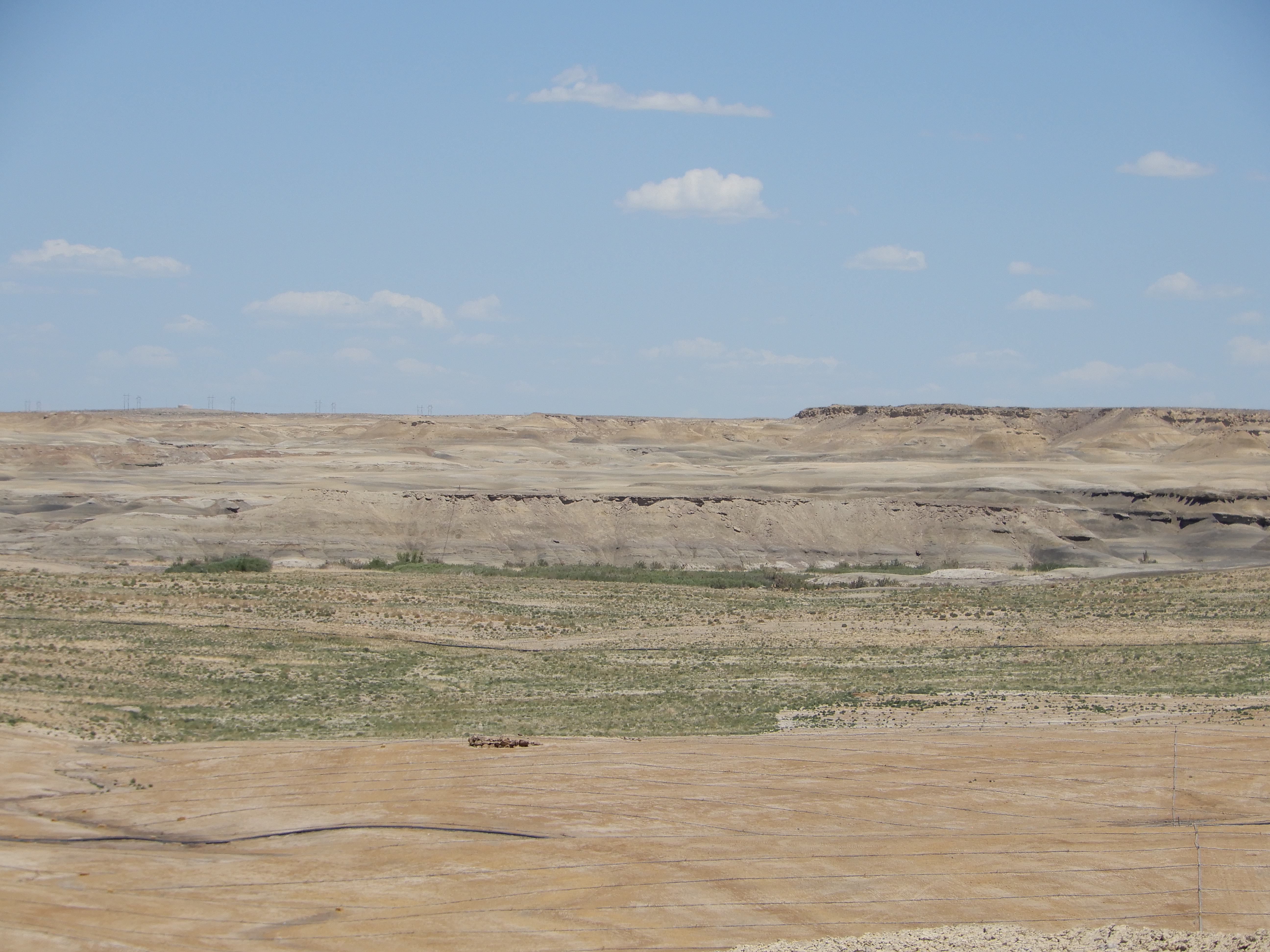
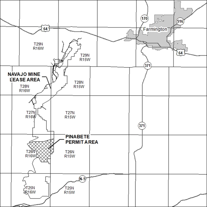
Navajo Transitional Energy Company (NTEC) submitted a permit renewal application to the Office of Surface Mining Reclamation and Enforcement Western Region (OSMRE). The permit renewal application consists of updated information contained in the currently approved permit application package OSMRE Permit No. NM-0042B. The permit renewal application is submitted to continue surface coal mining and reclamation operations within the Pinabete Permit Area (Navajo Tribal Coal Lease 14-20-603-2505) pursuant to the Code of Federal Regulations (CFR), Title 30, Subchapter E, Part 750, 773 and 774. This notice is hereby given that:
The Name and Business Address of the Applicant is:
Navajo Transitional Energy Company
P.O. Box 958
Shiprock, New Mexico, 87420
The mine permit boundary located in Sections 6, 7 and 18 of Township 26 North, Range 15 West and in Sections 1, 9 through 16, 22 through 26 in Township 26 North, Range 16 West, all West of the NMPM, San Juan County, New Mexico, more particularly described as follows:
Beginning at the North quarter corner of said Section 7, also designated as L-122;
thence South 00°19'52" West 5278.37 feet along the North - South centerline of said Section 7 to the South quarter corner of said Section 7, also known as L-124;
thence South 00°19'40" West 3958.77 feet to a monument marked L-126;
thence North 89°36'41" West 1320.09 feet to a monument marked L-128;
thence South 00°20'58" West 1319.82 feet to a monument marked L-130;
thence North 89°36'31" West 1261.62 feet to the northeast corner of said Section 24, also known as L-132; thence South 00°24'20" West 2639.30 feet along the East boundary of said Section 24 to the East quarter corner of said Section 24;
thence South 00°24'18" West 1319.54 feet to a monument marked L-134;
thence North 89°35'31" West 2638.64 feet to a monument marked L-136;
thence South 00°24'37" West 1319.51 feet to the South quarter corner of said Section 24,also known as L-138; thence South 00°25'01" West 1319.82 feet to a monument marked L-140;
thence North 89°35'55" West 4686.05 feet;
thence North 29°12'52" West 3430.69 feet;
thence North 10°31'01" West 836.09 feet;
thence South 81°49'22" West 1987.98 feet to a monument marked P8;
thence North 00°23'02" East 5204.28 feet to a monument marked P7;
thence North 67°07'50" West 4992.82 feet to a monument marked P6;
thence North 37°36'44" West 4998.66 feet to a monument marked P5;
thence North 61°10'20" East 1874.62 feet to a monument marked P4;
thence North 48°38'05" East 402.07 feet;
thence North 67°03'44" East 673.83 feet;
thence South 00°00'11" East 294.28 feet;
thence North 66°33'04" East 2275.61 feet;
thence South 89°59'58" East 8601.50 feet;
thence North 74°53'36" East 8472.21 feet;
thence South 00°14'46" West 1803.69 feet;
to the point of beginning, having an area of 5567.304 acres, more or less.
The Permit Renewal Application can be downloaded here: Pinabete Permit Renewal Application
Copies of the application are available for public review and/or inspection at the following locations:
The Navajo Nation
Minerals Department
Corner of Morgan Blvd and Window Rock Blvd
Window Rock, AZ 86515
(928) 871-6587
Office of Surface Mining Reclamation and Enforcement
One Denver Federal Center
Building 41
Lakewood, CO 80225-0065
OSMRE’s Website:
https://osmre.gov/programs/regulating-active-coal-mines/indian-lands
Tiis Tsoh Sikaad (Burnham) Chapter
12 miles east of US 491 on Navajo Route 5 and 0.5 mile South on Navajo Route 5080
Newcomb, NM 87455
Nenahnezad Chapter
West Hwy 64, South on County Road 6675, North on Navajo Route 365,
Fruitland, NM 87416
Farmington Public Library
2101 Farmington Ave
Farmington, NM 87401
Any person with an interest that is or may be adversely affected may submit written comments, objections, or a request for an informal conference on the application on or before 5:00 p.m. MDT, May 11, 2026, which is no less than 30 days of the fourth and last publication of this notice. The name and address of the OSMRE representative where written comments, objections, or requests for an informal conference may be submitted is:
Flynn Dickinson
Navajo Mine Team Leader
Office of Surface Mining Reclamation and Enforcement
Western Region Indian Lands Program
P.O. Box 25065
Lakewood, Colorado 80225-0065
email: [email protected]
The application has been filed with OSMRE and will be acted upon pursuant to the permanent regulatory program for Indian Lands (30 CFR Part 750) approved by the Secretary of the Interior under Title V of the Surface Mining Control and Reclamation Act of 1977.
This permit renewal application is authored and provided by NTEC for OSM's review and decision. If you need assistance with this electronic document related to accessibility, please contact Mychal Yellowman at [email protected] )
Navajo & Pinabete Mines
The Navajo Mine consists of two SMCRA Permits, the Navajo Mine Permit: NM-0003 and the Pinabete Permit: NM-0042.
The Navajo & Pinabete Mines are located on the Navajo Nation near Fruitland, New Mexico. The Navajo & Pinabete Mines are surface mining operations and are the only active mining operations on the Navajo Nation.
View the Navajo Mine Storymap
For more information on the Navajo & Pinabete Mines, OSMRE Mine Team Leader, Flynn Dickinson at [email protected]
Public Notice: McKinley Mine Permit No. NM-0001 Renewal Application
Chevron Mining Inc. (CMI) has filed a request for renewal of its McKinley Mine Permit No. NM-0001K pursuant to 30 CFR 774.15. CMI headquarters are located at 1400 Smith Street, Houston, TX 77002. The request was filed with the Office of Surface Mining Reclamation and Enforcement (OSM) in Denver, CO. Upon approval of the renewal application, the new permit number will be NM-0001L.
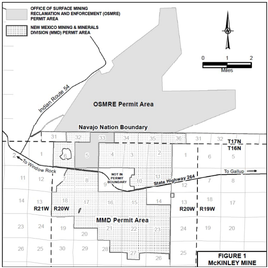
The McKinley Mine is located approximately 23 miles northwest of Gallup, NM and 3 miles east of Window Rock, AZ on NM State Highway 264. The portion of the McKinley Mine permitted under Permit No. NM-0001K is located on lands within the Navajo-Nation boundary generally in Township 17 North, Ranges 19, 20 and 21 West, and on Navajo-Nation owned lands in Section 5, Township 16 North, Range 20 West, and Section 33, Township 17 North, Range 20 West, New Mexico Principal Meridian, McKinley County, New Mexico. The permit-renewal area is shown on the map that accompanies this notice (Figure 1).
The McKinley Mine Permit No. NM-0001 Permit Renewal Application can be downloaded here:
McKinley Mine Permit No. NM-0001 Permit Renewal Application
This application is authored and provided by PWCC for OSM's review and decision. If you need assistance with this electronic document related to accessibility, please contact Mychal Yellowman at [email protected]
A copy of the permit renewal application is also available for public review and/or inspection at the following locations:
County Clerk
McKinley County Courthouse
207 West Hill Street
Gallup, New Mexico 87301
The Navajo Nation
Minerals Department
Corner of Morgan Blvd and Window Rock Blvd
Window Rock, AZ 86515
(928) 871-6587
Any person with an interest that is or may be adversely affected may submit written comments, objections, or a request for an informal conference on the application, within 30 days of the fourth and last publication of this notice. A request for an informal conference must briefly summarize the issues to be raised by the requestor at the conference and must state whether the requestor desires to have the conference conducted in the locality of the proposed operation. The name and address of the OSMRE representative where written comments, objections, or requests for an informal conference may be submitted is:
Ms. Christina Luciani
Office of Surface Mining Reclamation and Enforcement
Western Region Indian Lands Program
PO Box 25065
Lakewood, CO 80225-0065
Vegetation Management Units 2, 3, 5 and 8 Application for Permanent Program Bond Release
Chevron Mining Inc. (CMI) has filed an application for bond release of Permanent Program Lands in Vegetation Management Units 2, 3, 5 and 8 (VMU 2, VMU 3, VMU 5 and VMU 8) contained in the McKinley Mine’s mining and reclamation Permit No. NM-0001K (Permit NM-0001K) approved 09-07-2016, located in McKinley County, New Mexico.
VMU 2: The application includes a request for a Phase I, II and III bond release on two permanent impoundments in VMU 2 and Phase III bond release for the remaining area. The application contains information to demonstrate that 1,073 acres meet applicable requirements contained in the McKinley Mine’s Permit NM-0001K, and the regulatory performance standards in 30 CFR 715, 800 and 816. Initial seeding in VMU 2 generally spans a period from 1975 to 2013. The current performance bond is $53,921,545 and with this reclamation complete, the application includes calculations to reduce the associated reclamation performance bond by $1,860,000.
VMU 3: The application includes a request for a Phase III bond release for the entire VMU 3 area. The application contains information to demonstrates that 858 acres meet applicable requirements contained in the McKinley Mine’s Permit NM-0001K, and the regulatory performance standards in 30 CFR 715, 800 and 816. Initial seeding in VMU 3 generally spans a period from 1975 to 2013. The current performance bond is $53,921,545 and with this reclamation complete, the application includes calculations to reduce the associated reclamation performance bond by $1,039,000.
VMU 5: The application includes a request for a Phase I, II and III bond release on seven permanent impoundments in VMU 5 and Phase III bond release for the remaining area. The application contains information to demonstrates that 1,049 acres meet applicable requirements contained in the McKinley Mine’s Permit NM-0001K, and the regulatory performance standards in 30 CFR 715, 800 and 816. Initial seeding in VMU 5 generally spans a period from 1975 to 2013. The current performance bond is $53,921,545 and with this reclamation complete, the application includes calculations to reduce the associated reclamation performance bond by $2,168,000.
VMU 8: The application includes a request for a Phase I, II and III bond release on one permanent impoundment in VMU 8 and Phase III bond release for the remaining area. The application contains information to demonstrates that 794 acres meet applicable requirements contained in the McKinley Mine’s Permit NM-0001K, and the regulatory performance standards in 30 CFR 715, 800 and 816. Initial seeding in VMU 8 generally spans a period from 1975 to 2013. The current performance bond is $53,921,545 and with this reclamation complete, the application includes calculations to reduce the associated reclamation performance bond by $1,202,000.
The McKinley Mine is located approximately 22 miles northwest of Gallup, NM, and 2 miles east of Window Rock, AZ, on NM State Highway 264. Figure 1 shows the location and configurations of VMU 2,3,5 and 8. The McKinley Mine is currently permitted by CMI (formerly the Pittsburg & Midway Coal Mining Co.) but now managed by Chevron Environmental Management Company (CEMC). CEMC is located at 6001 Bollinger Canyon Road, Building C-2144, San Ramon, CA, 94583. The application was filed with the Office of Surface Mining Reclamation and Enforcement (OSMRE) Western Region Office in Denver, Colorado, which has jurisdiction for the McKinley Mine on Navajo Nation lands.
VMU 2, 3, 5 and 8 are situated on land leased from the Navajo Nation to conduct mining and reclamation on lands in the Navajo Reservation. These lands are generally located in former Mining Areas 1, 2, 3, 5, and 10 in the northern part of the McKinley Mine. Mining has been completed as have required reclamation activities that include backfilling and grading, installation of hydrologic controls, topdressing, and revegetation. The Office of Surface Mining has previously approved Phase I and II applications for these lands that included all categories of reclamation with the exception of a demonstration that the mine has successfully revegetated the land to meet the revegetation success standards in Permit No. NM-000K. This application contains information that the revegetation success standards have been met and that the land can be released from further reclamation liability.
A copy of the reclamation liability release and termination of jurisdiction application is available for public inspection at the following locations:
County Clerk’s Office
McKinley County Courthouse
207 W. Hill Ave.
Gallup, NM 87301
The Navajo Nation Minerals Department – Office of Surface Mining Program
Window Rock Blvd.
Window Rock, AZ 86515
Within 30 days of the fourth and final publication of this bond release application notice in the Navajo Times newspaper, written comments, objections, or requests for a public hearing and informal conference on this reclamation liability release application shall be submitted to:
Mr. Jacob Mulinix
Office of Surface Mining Reclamation & Enforcement
Western Region Office
P. O. Box 25065
One Federal Center, Building 41 Lakewood, CO 80225-0065
303-236-4700
Email: [email protected]
The reclamation liability bond release & termination of jurisdiction applications was authored and provided by Chevron Mining Inc. (CMI) for OSM's review and decision. If you need assistance with these electronic documents related to accessibility, please contact Mychal Yellowman at [email protected] )
McKinley North Mine
The McKinley North Mine is located on the Navajo Nation near Tse Bonito, New Mexico. The McKinley Mine only had reclamation activities.
For more information on the McKinley North Mine, contact OSMRE Mine Team Leader, Jacob Mulinix at [email protected]

The King II Mine is an underground mine that is partially located under private land owned by the Ute Mountain Ute Tribe. The mine is near Hesperus, Colorado.
For more information on the Kind II Mine, contact OSMRE Mine Team Leader, Jeremy Spangler at [email protected]
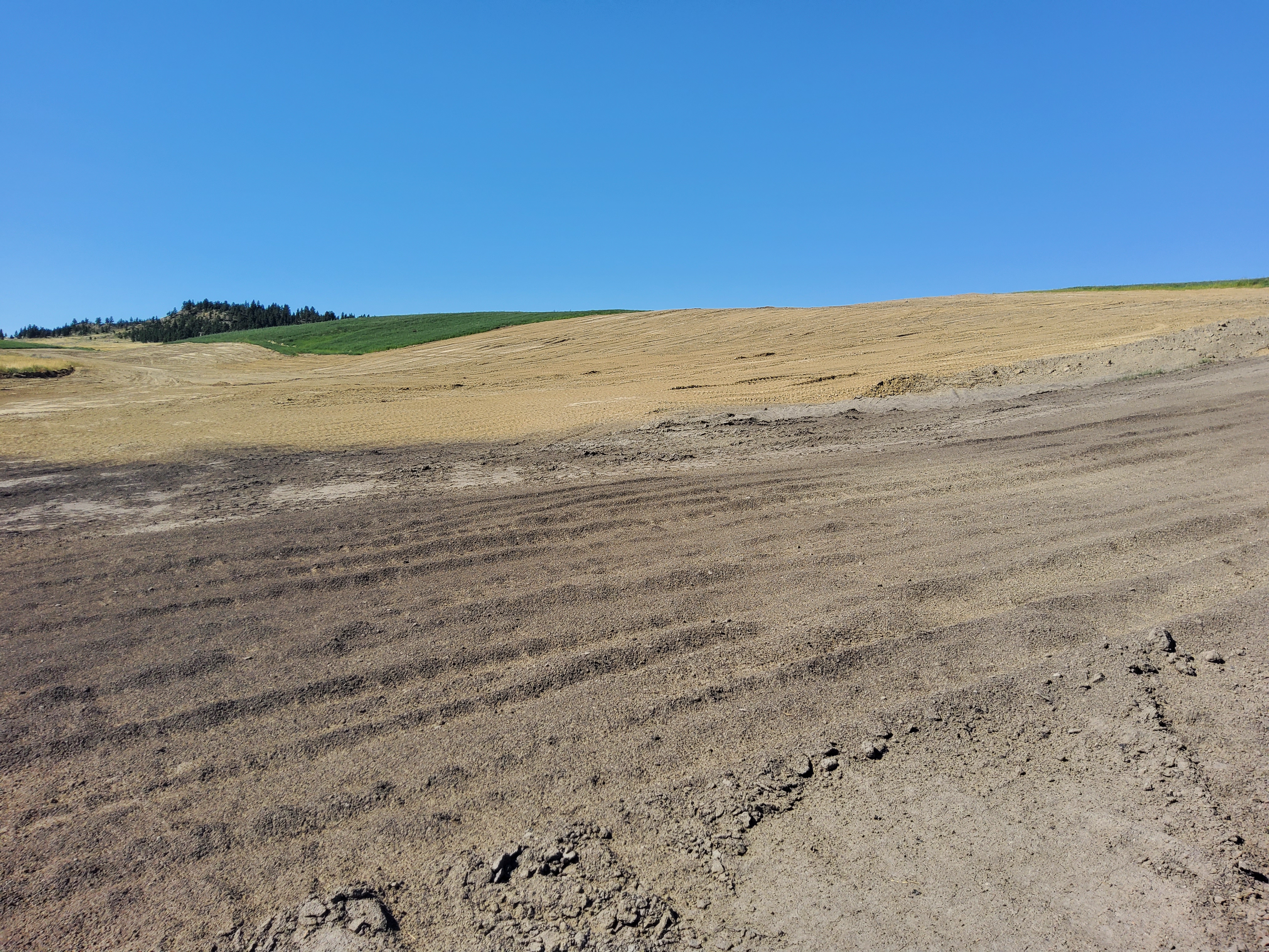
OSMRE's Casper Field Office is the regulatory authority for the Absaloka South Mine. The Absaloka South Mine is located on Crow Tribal Surface.
For more information on the Absaloka South Mine, contact OSMRE Mine Team Leader, Frank Bartlett at [email protected]
OSMRE's Tulsa Field Office is the regulatory authority for the McCurtain Mine. The McCurtain Mine is located within the external boundaries of the historic Choctaw Nation Reservation in Oklahoma.
For more information on the McCurtain Mine, contact Brian Hicks at [email protected].
Farrell-Cooper Mining Company has applied to OSMRE for a permit to mine coal by underground methods. Under the federal Indian lands program, permit OK-042F-CC essentially would be a reissue of permit 4285F that had been issued by the Oklahoma Department of Mines in March 2012.
- Public Notice (Dated 09/1/2022)
Any person whose interest may be adversely affected by the reissuance of the permit may make written comments to the Office of Surface Mining Reclamation and Enforcement, 501 Belle Street, Suite 216, Alton, IL 62002.
Comments, objections, or request for an informal conference must be submitted by October 1, 2022.